 vesseltracker.com
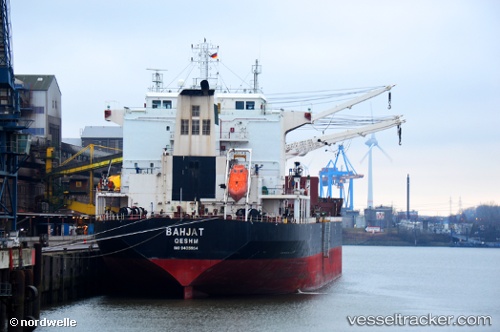
Bahjat
Current StatusWhere is the vessel?
Bahjat is currently in 57 nm NE of MALAHAYATI, based on AIS data received less than 1h ago.
Latest AIS update:
Current position: 6.15357° N, 96.29898° E (57 nm NE of MALAHAYATI)
Average speed (last 7 days): Loading…
Average speed (last 30 days): Loading…
Vessel profile: Bahjat is a Bulk Carrier with dimensions 32m x 190m.
This page combines live AIS, route history, probable destination signals, nearby traffic, and port activity for practical vessel monitoring.
The current position of vessel Bahjat is 6.15357 lat / 96.29898 lng. Updated: 2026-04-29 07:19:55 UTCNearest reference points:
- 53 nm NE of Sebang
- 21 nm N of Sebang
- 45 nm NE of Krueng Geukueh
Details:
Live Vessel Bahjat Analytics (details, animations, etc.)
Recent AIS points (UTC):
2026-04-29 04:41:40 UTC · 6.10333, 96.67333 · SOG 8 kn · COG -1°2026-04-29 05:38:39 UTC · 6.12167, 96.54167 · SOG 8 kn · COG -1°
2026-04-29 06:56:38 UTC · 6.14500, 96.35500 · SOG 8 kn · COG -1°
2026-04-29 07:19:55 UTC · 6.15357, 96.29898 · SOG 8.7 kn · COG 278°