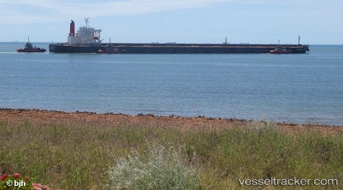
.
Vessel photo of XIN HAI (IMO 9406477) vesseltracker.com

LB flag XIN HAI

Vessel type: Bulk Carrier | IMO: 9406477 | MMSI: MMSI: 636021720
Call sign: 5LFJ5 | Dimensions: 50 m x 300 m
Current Status

Where is the vessel?

XIN HAI is currently in Open sea, approx. 413 nm off the nearest listed port, based on AIS data received about 1h ago.

Latest AIS update:

Current position: 2.83460° S, 6.55317° W (Open sea, approx. 413 nm off the nearest listed port)

Average speed (last 7 days): Loading…

Average speed (last 30 days): Loading…

Vessel profile: XIN HAI is a Bulk Carrier with dimensions 50m x 300m.

This page combines live AIS, route history, probable destination signals, nearby traffic, and port activity for practical vessel monitoring.

The current position of vessel XIN HAI is -2.83460 lat / -6.55317 lng. Updated: 2026-05-14 07:21:37 UTC
Nearest reference points:
  • Open sea, approx. 413 nm off the nearest listed port
  • Open sea, approx. 412 nm off the nearest listed port
  • Open sea, approx. 411 nm off the nearest listed port

Currently sailing under the flag of Liberia LB flag

XIN HAI built in 2007 year

Deadweight:
206331 t

Details:

Live Vessel XIN HAI Analytics (details, animations, etc.)


Recent AIS points (UTC):
2026-05-14 04:12:29 UTC · -3.32333, -6.19703 · SOG 11.5 kn · COG 327°
2026-05-14 06:20:36 UTC · -2.99062, -6.43695 · SOG 11.4 kn · COG 325°
2026-05-14 07:01:09 UTC · -2.88700, -6.51463 · SOG 11.3 kn · COG 325°
2026-05-14 07:21:37 UTC · -2.83460, -6.55317 · SOG 11.2 kn · COG 325°

Track of the vessel in the last 60 days


UTC: --
Start: -- Track timeline (UTC) End: --
Encountered: --


Link to the map:


Find another ship

XIN_HAI (636021720) last ports (portcalls and passsages)

Rizhao Pt | 2025-09-14 11:40:21
SURALAYA | 2025-09-02 02:24:47
MERAK | 2025-09-02 01:09:06
Selat Sunda | 2025-09-02 00:22:02
Sebang | 2025-06-22 19:10:04
Ta-Ku | 2025-06-06 04:23:05
Dagu Bar | 2025-06-06 02:58:33
Taku Bar | 2025-06-06 01:36:50
MERAK | 2025-05-25 04:13:25
Takoradi | 2025-04-20 08:16:54
Takoradi | 2025-04-16 08:05:32
Takoradi | 2025-04-12 07:21:07
Takoradi | 2025-04-08 06:57:07
PULAU SAMBU | 2025-03-08 14:41:31
TANAH MERAH | 2025-03-07 22:14:36
PENGERANG | 2025-03-07 19:25:19
Fangcheng | 2025-03-03 02:23:40
Fangcheng | 2025-02-27 01:15:48
SURALAYA | 2025-02-10 17:12:47
CIWANDAN | 2025-02-10 16:10:12
Cape Of Good Hope | 2024-12-16 22:38:55
Sebang | 2024-11-27 16:11:21
BUKOM ISLAND | 2024-11-25 15:43:18
BATU AMPAR | 2024-11-25 14:27:46
TANAH MERAH | 2024-11-24 14:19:54
PENGERANG | 2024-11-24 12:59:04
JINGTANG | 2024-11-11 19:06:12
Singapore | 2024-08-05 07:08:44
Jingjiang | 2024-07-27 07:59:58
Zhangjiagang | 2024-07-24 09:43:34
Nantong | 2024-07-24 06:58:42
Taicang | 2024-07-24 03:16:16
Wusong | 2024-07-23 06:06:41
Jingjiang | 2024-07-23 01:02:34
Sebang | 2024-04-23 01:40:06
Singapore | 2024-04-20 20:47:15
Selat Lombok | 2023-08-11 05:27:11
Samson Point | 2023-08-06 05:54:15
Bayuquan | 2023-07-18 20:30:34
Selat Lombok | 2023-07-03 14:04:22
Samson Point | 2023-06-28 16:01:37
Samson Point | 2023-06-24 14:29:14
Selat Lombok | 2023-06-21 21:15:25
Taicang | 2023-06-12 04:09:33
Wusong | 2023-06-08 20:05:30
Lianyungang | 2023-06-04 22:35:05
Selat Lombok | 2023-05-22 16:31:59
Samson Point | 2023-05-17 13:19:38
Selat Lombok | 2023-05-14 20:50:44
Taicang | 2023-05-02 23:37:26
Wusong | 2023-05-02 15:09:15
Selat Lombok | 2023-04-11 02:58:00
Dampier | 2023-02-23 08:28:38
Qingdao | 2023-02-06 05:35:29
Dampier | 2023-01-14 08:44:40
Selat Lombok | 2023-01-08 05:48:59
Yokkaichi | 2022-05-06 13:12:15
Nagoya | 2022-05-04 04:02:13
Yokkaichi | 2022-05-02 12:14:27
Oita | 2022-04-19 09:19:09
Gladstone Harbor | 2022-03-30 21:30:43
Sambu | 2022-02-06 15:00:07