 vesseltracker.com
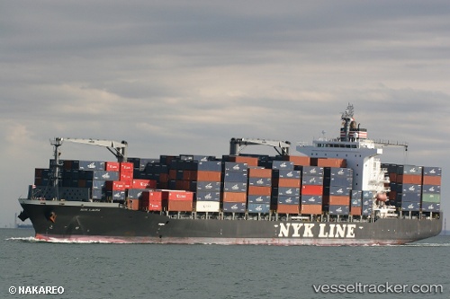
 NYK LAURA
Current Status
Where is the vessel?
NYK LAURA is currently in Near Wilmington, based on AIS data received about 2h ago.
Latest AIS update:
Current position: 33.75992° N, 118.25723° W (Near Wilmington)
Average speed (last 7 days): Loading…
Average speed (last 30 days): Loading…
Vessel profile: NYK LAURA is a Container Ship with dimensions 210m x 30m.
This page combines live AIS, route history, probable destination signals, nearby traffic, and port activity for practical vessel monitoring.
The current position of vessel NYK LAURA is 33.75992 lat / -118.25723 lng. Updated: 2026-05-13 19:21:58 UTCNearest reference points:
- Near Los Angeles
- Near Long Beach
- Near Seal Beach
Currently sailing under the flag of Marshall Islands ![]()
NYK LAURA built in 2009 year
Deadweight:
34576 tDetails:
Live Vessel NYK LAURA Analytics (details, animations, etc.)
Recent AIS points (UTC):
2026-05-13 16:12:52 UTC · 33.76000, -118.25720 · SOG 0 kn · COG 67°2026-05-13 17:51:53 UTC · 33.76003, -118.25719 · SOG 0 kn · COG 68°
2026-05-13 19:00:50 UTC · 33.76004, -118.25717 · SOG 0 kn · COG 67°
2026-05-13 19:21:58 UTC · 33.75992, -118.25723 · SOG 0 kn · COG 67°