 vesseltracker.com
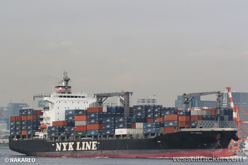
Nyk Maria
Current StatusWhere is the vessel?
Nyk Maria is currently in 63 nm NE of Lü-hua Shan, based on AIS data received about 1h ago.
Latest AIS update:
Current position: 31.43972° N, 123.59740° E (63 nm NE of Lü-hua Shan)
Average speed (last 7 days): Loading…
Average speed (last 30 days): Loading…
Vessel profile: Nyk Maria is a Container Ship with dimensions 30m x 210m.
This page combines live AIS, route history, probable destination signals, nearby traffic, and port activity for practical vessel monitoring.
The current position of vessel Nyk Maria is 31.43972 lat / 123.59740 lng. Updated: 2026-04-25 02:21:55 UTCNearest reference points:
- 70 nm NE of Jingjiang
- 44 nm E of Lü-hua Shan
- 56 nm E of Lü-hua Shan
Details:
Live Vessel Nyk Maria Analytics (details, animations, etc.)
Recent AIS points (UTC):
2026-04-24 22:24:56 UTC · 31.44206, 123.59677 · SOG 0 kn · COG 107°2026-04-25 00:09:54 UTC · 31.44072, 123.59658 · SOG 0 kn · COG 69°
2026-04-25 01:21:57 UTC · 31.44013, 123.59699 · SOG 0 kn · COG 40°
2026-04-25 02:21:55 UTC · 31.43972, 123.59740 · SOG 0.1 kn · COG 28°