 vesseltracker.com
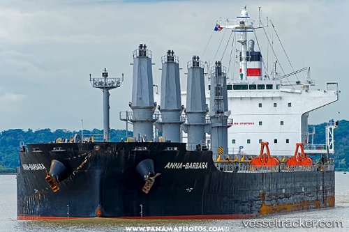
 ANNA BARBARA
Current Status
Where is the vessel?
ANNA BARBARA is currently in 74 nm NE of Cidade de Angra dos Reis FPSO, based on AIS data received less than 1h ago.
Latest AIS update:
Current position: 25.01833° S, 41.59167° W (74 nm NE of Cidade de Angra dos Reis FPSO)
Average speed (last 7 days): Loading…
Average speed (last 30 days): Loading…
Vessel profile: ANNA BARBARA is a Bulk Carrier with dimensions m x m.
This page combines live AIS, route history, probable destination signals, nearby traffic, and port activity for practical vessel monitoring.
The current position of vessel ANNA BARBARA is -25.01833 lat / -41.59167 lng. Updated: 2026-05-14 02:50:18 UTCNearest reference points:
- 69 nm NE of Cidade de Angra dos Reis FPSO
- 34 nm S of Cidade de Angra dos Reis FPSO
- 47 nm E of Arraial do Cabo
Currently sailing under the flag of Liberia ![]()
Details:
Live Vessel ANNA BARBARA Analytics (details, animations, etc.)
Recent AIS points (UTC):
2026-05-13 22:33:53 UTC · -24.35986, -40.98953 · SOG 11.8 kn · COG 217°2026-05-13 23:38:04 UTC · -24.52334, -41.14094 · SOG 12.3 kn · COG 217°
2026-05-14 02:03:00 UTC · -24.90055, -41.48175 · SOG 11.4 kn · COG 220°
2026-05-14 02:50:18 UTC · -25.01833, -41.59167 · SOG 11 kn · COG -1°