 vesseltracker.com
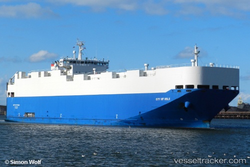
 CITY OF OSLO
Current Status
Where is the vessel?
CITY OF OSLO is currently in 109 nm N of ISLA MUJERES, based on AIS data received less than 1h ago.
Latest AIS update:
Current position: 23.05833° N, 86.80167° W (109 nm N of ISLA MUJERES)
Average speed (last 7 days): Loading…
Average speed (last 30 days): Loading…
Vessel profile: CITY OF OSLO is a Vehicles Carrier with dimensions 140m x 22m.
This page combines live AIS, route history, probable destination signals, nearby traffic, and port activity for practical vessel monitoring.
The current position of vessel CITY OF OSLO is 23.05833 lat / -86.80167 lng. Updated: 2026-05-14 23:27:05 UTCNearest reference points:
- Near Puerto Juárez
Currently sailing under the flag of Marshall Islands ![]()
CITY OF OSLO built in 2010 year
Deadweight:
5432 tDetails:
Live Vessel CITY OF OSLO Analytics (details, animations, etc.)
Recent AIS points (UTC):
2026-05-14 19:45:03 UTC · 22.97500, -87.58167 · SOG 12 kn · COG -1°2026-05-14 21:48:02 UTC · 23.02333, -87.14167 · SOG 11 kn · COG -1°
2026-05-14 23:06:06 UTC · 23.05333, -86.87500 · SOG 11 kn · COG -1°
2026-05-14 23:27:05 UTC · 23.05833, -86.80167 · SOG 11 kn · COG -1°