 vesseltracker.com
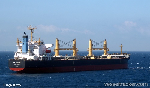
 AN CHANG
Current Status
Where is the vessel?
AN CHANG is currently in Near Yilport, based on AIS data received about 1h ago.
Latest AIS update:
Current position: 40.76954° N, 29.51273° E (Near Yilport)
Average speed (last 7 days): Loading…
Average speed (last 30 days): Loading…
Vessel profile: AN CHANG is a Bulk Carrier with dimensions 190m x 32m.
This page combines live AIS, route history, probable destination signals, nearby traffic, and port activity for practical vessel monitoring.
The current position of vessel AN CHANG is 40.76954 lat / 29.51273 lng. Updated: 2026-04-30 01:59:48 UTCNearest reference points:
- Near Yilport
- Near YALOVA
- Near Diliskelesi
Currently sailing under the flag of China Peopless Republic ![]()
AN CHANG built in 2009 year
Deadweight:
55217 tDetails:
Live Vessel AN CHANG Analytics (details, animations, etc.)
Recent AIS points (UTC):
2026-04-29 23:05:50 UTC · 40.76956, 29.51275 · SOG 0 kn · COG 140°2026-04-30 00:11:50 UTC · 40.76955, 29.51272 · SOG 0 kn · COG 140°
2026-04-30 01:32:48 UTC · 40.76956, 29.51272 · SOG 0 kn · COG 140°
2026-04-30 01:59:48 UTC · 40.76954, 29.51273 · SOG 0 kn · COG 140°