 vesseltracker.com
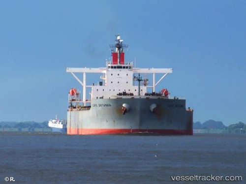
Cape Britannia
Current StatusWhere is the vessel?
Cape Britannia is currently in 106 nm SE of NISHINOOMOTE, based on AIS data received about 22h ago.
Latest AIS update:
Current position: 29.15855° N, 131.91077° E (106 nm SE of NISHINOOMOTE)
Average speed (last 7 days): Loading…
Average speed (last 30 days): Loading…
Vessel profile: Cape Britannia is a Ore Carrier with dimensions 45m x 292m.
This page combines live AIS, route history, probable destination signals, nearby traffic, and port activity for practical vessel monitoring.
The current position of vessel Cape Britannia is 29.15855 lat / 131.91077 lng. Updated: 2026-05-14 22:52:45 UTCNearest reference points:
- 107 nm NE of Kitadaito Apt
- Near YAMAGAWA
- Near Kiire
Details:
Live Vessel Cape Britannia Analytics (details, animations, etc.)
Recent AIS points (UTC):
2026-05-14 18:21:46 UTC · 29.20248, 132.80322 · SOG 10.8 kn · COG 266°2026-05-14 18:21:46 UTC · 29.20248, 132.80322 · SOG 10.8 kn · COG 266°
2026-05-14 22:52:45 UTC · 29.15855, 131.91077 · SOG 9.6 kn · COG 263°
2026-05-14 22:52:45 UTC · 29.15855, 131.91077 · SOG 9.6 kn · COG 263°