 vesseltracker.com
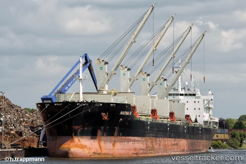
 MARINA R
Current Status
Where is the vessel?
MARINA R is currently in 40 nm E of Cua Lo, based on AIS data received less than 1h ago.
Latest AIS update:
Current position: 18.90333° N, 106.42167° E (40 nm E of Cua Lo)
Average speed (last 7 days): Loading…
Average speed (last 30 days): Loading…
Vessel profile: MARINA R is a Bulk Carrier with dimensions m x m.
This page combines live AIS, route history, probable destination signals, nearby traffic, and port activity for practical vessel monitoring.
The current position of vessel MARINA R is 18.90333 lat / 106.42167 lng. Updated: 2026-04-25 02:54:54 UTCNearest reference points:
- Near Nghi Son
- 60 nm NE of Son Duong Port
- 65 nm W of Basuo Pt
Currently sailing under the flag of Marshall Islands ![]()
Details:
Live Vessel MARINA R Analytics (details, animations, etc.)
Recent AIS points (UTC):
2026-04-24 23:58:34 UTC · 19.23979, 105.94200 · SOG 11.8 kn · COG 123°2026-04-25 01:24:49 UTC · 19.06833, 106.17500 · SOG 11 kn · COG -1°
2026-04-25 01:57:54 UTC · 19.00667, 106.26833 · SOG 11 kn · COG -1°
2026-04-25 02:54:54 UTC · 18.90333, 106.42167 · SOG 11 kn · COG -1°