 vesseltracker.com
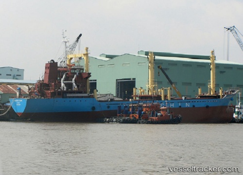
 Taydo Star
Current Status
Where is the vessel?
Taydo Star is currently in Near Tra Noc, based on AIS data received about 7h ago.
Latest AIS update:
Current position: 10.08865° N, 105.73362° E (Near Tra Noc)
Average speed (last 7 days): Loading…
Average speed (last 30 days): Loading…
Vessel profile: Taydo Star is a General Cargo Ship with dimensions 103m x 17m.
This page combines live AIS, route history, probable destination signals, nearby traffic, and port activity for practical vessel monitoring.
The current position of vessel Taydo Star is 10.08865 lat / 105.73362 lng. Updated: 2026-05-14 00:07:53 UTCNearest reference points:
- Near Dong Son
- 21 nm E of Cai Cui Port
- Near Nha Be
Currently sailing under the flag of Vietnam ![]()
Taydo Star built in 2007 year
Deadweight:
6485 tDetails:
Live Vessel Taydo Star Analytics (details, animations, etc.)
Recent AIS points (UTC):
2026-05-14 00:07:53 UTC · 10.08865, 105.73362 · SOG 0 kn · COG 121°2026-05-14 00:07:53 UTC · 10.08865, 105.73362 · SOG 0 kn · COG 121°
2026-05-14 00:07:53 UTC · 10.08865, 105.73362 · SOG 0 kn · COG 121°
2026-05-14 00:07:53 UTC · 10.08865, 105.73362 · SOG 0 kn · COG 121°