 vesseltracker.com
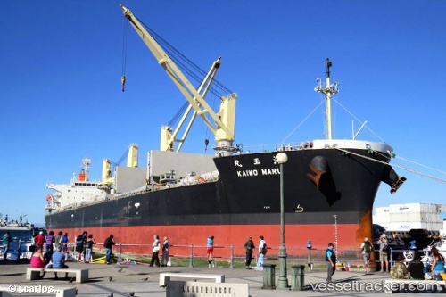
 Kaiwo Maru
Current Status
Where is the vessel?
Kaiwo Maru is currently in Near Puerto Sandino, based on AIS data received about 4h ago.
Latest AIS update:
Current position: 12.18201° N, 86.78986° W (Near Puerto Sandino)
Average speed (last 7 days): Loading…
Average speed (last 30 days): Loading…
Vessel profile: Kaiwo Maru is a Bulk Carrier with dimensions 183m x 32m.
This page combines live AIS, route history, probable destination signals, nearby traffic, and port activity for practical vessel monitoring.
The current position of vessel Kaiwo Maru is 12.18201 lat / -86.78986 lng. Updated: 2026-05-14 07:42:44 UTCNearest reference points:
- Near El Salvador
- 27 nm W of Playa Conchal
- Near Golfo de Papagayo
Currently sailing under the flag of Panama ![]()
Kaiwo Maru built in 2011 year
Deadweight:
50808 tDetails:
Live Vessel Kaiwo Maru Analytics (details, animations, etc.)
Recent AIS points (UTC):
2026-05-14 07:42:44 UTC · 12.18201, -86.78986 · SOG 0 kn · COG 125°2026-05-14 07:42:44 UTC · 12.18201, -86.78986 · SOG 0 kn · COG 125°
2026-05-14 07:42:44 UTC · 12.18201, -86.78986 · SOG 0 kn · COG 125°
2026-05-14 07:42:44 UTC · 12.18201, -86.78986 · SOG 0 kn · COG 125°