 vesseltracker.com
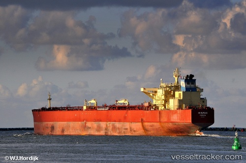
 BRATSK
Current Status
Where is the vessel?
BRATSK is currently in 81 nm N of Belmullet, based on AIS data received less than 1h ago.
Latest AIS update:
Current position: 55.47018° N, 10.83651° W (81 nm N of Belmullet)
Average speed (last 7 days): Loading…
Average speed (last 30 days): Loading…
Vessel profile: BRATSK is a Crude Oil Tanker with dimensions 275m x 48m.
This page combines live AIS, route history, probable destination signals, nearby traffic, and port activity for practical vessel monitoring.
The current position of vessel BRATSK is 55.47018 lat / -10.83651 lng. Updated: 2026-05-15 21:25:55 UTCNearest reference points:
- 10 nm NE of Belmullet
Currently sailing under the flag of Russia ![]()
BRATSK built in 2009 year
Deadweight:
156572 tDetails:
Live Vessel BRATSK Analytics (details, animations, etc.)
Recent AIS points (UTC):
2026-05-15 17:25:45 UTC · 56.24500, -10.49167 · SOG 11 kn · COG -1°2026-05-15 19:13:47 UTC · 55.90833, -10.64167 · SOG 11 kn · COG -1°
2026-05-15 19:58:46 UTC · 55.76500, -10.70167 · SOG 12 kn · COG -1°
2026-05-15 21:25:55 UTC · 55.47018, -10.83651 · SOG 12.7 kn · COG 196°