 vesseltracker.com
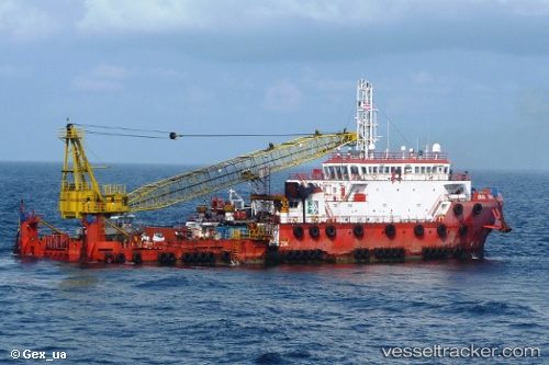
Armada Firman 2
Current StatusWhere is the vessel?
Armada Firman 2 is currently in 16 nm SW of Platong, based on AIS data received less than 1h ago.
Latest AIS update:
Current position: 9.45833° N, 101.27500° E (16 nm SW of Platong)
Average speed (last 7 days): Loading…
Average speed (last 30 days): Loading…
Vessel profile: Armada Firman 2 is a Offshore Support Vessel with dimensions 20m x 75m.
This page combines live AIS, route history, probable destination signals, nearby traffic, and port activity for practical vessel monitoring.
The current position of vessel Armada Firman 2 is 9.45833 lat / 101.27500 lng. Updated: 2026-05-14 18:10:55 UTCNearest reference points:
- Near Samui Apt
- 46 nm W of Dai Hung (STS Load)
- Near Ko Samui
Details:
Live Vessel Armada Firman 2 Analytics (details, animations, etc.)
Recent AIS points (UTC):
2026-05-14 14:22:54 UTC · 9.45667, 101.27500 · SOG 0 kn · COG -1°2026-05-14 15:28:53 UTC · 9.45667, 101.27500 · SOG 0 kn · COG -1°
2026-05-14 16:49:55 UTC · 9.45833, 101.27500 · SOG 0 kn · COG -1°
2026-05-14 18:10:55 UTC · 9.45833, 101.27500 · SOG 0 kn · COG -1°