 vesseltracker.com
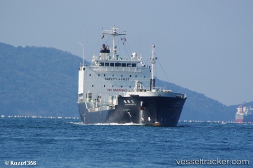
 BITUMEN SHOURI
Current Status
Where is the vessel?
BITUMEN SHOURI is currently in Near Pasir Panjang Wharves, based on AIS data received less than 1h ago.
Latest AIS update:
Current position: 1.24353° N, 103.79823° E (Near Pasir Panjang Wharves)
Average speed (last 7 days): Loading…
Average speed (last 30 days): Loading…
Vessel profile: BITUMEN SHOURI is a Asphalt/Bitumen Tanker with dimensions m x m.
This page combines live AIS, route history, probable destination signals, nearby traffic, and port activity for practical vessel monitoring.
The current position of vessel BITUMEN SHOURI is 1.24353 lat / 103.79823 lng. Updated: 2026-05-14 10:45:13 UTCNearest reference points:
- Near Singapore
- Near Pasir Panjang Wharves
- Near Bukit Merah Estate
Currently sailing under the flag of Indonesia ![]()
Details:
Live Vessel BITUMEN SHOURI Analytics (details, animations, etc.)
Recent AIS points (UTC):
2026-05-14 07:45:13 UTC · 1.24308, 103.79968 · SOG 0 kn · COG 257°2026-05-14 07:54:12 UTC · 1.24300, 103.79962 · SOG 0 kn · COG 260°
2026-05-14 09:21:15 UTC · 1.24382, 103.79858 · SOG 0.1 kn · COG 170°
2026-05-14 10:45:13 UTC · 1.24353, 103.79823 · SOG 0 kn · COG 143°