 vesseltracker.com
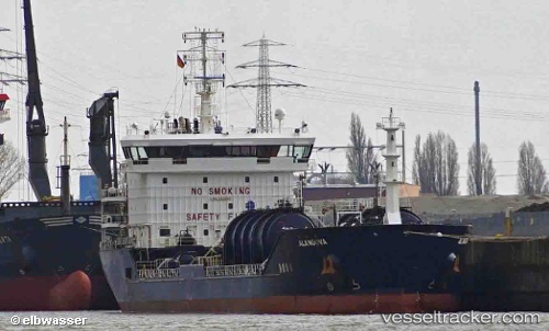
Alangova
Current StatusWhere is the vessel?
Alangova is currently in 30 nm SE of Sheppard, based on AIS data received less than 1h ago.
Latest AIS update:
Current position: 28.92356° N, 94.42799° W (30 nm SE of Sheppard)
Average speed (last 7 days): Loading…
Average speed (last 30 days): Loading…
Vessel profile: Alangova is a Chemical Oil Products Tanker with dimensions 21m x 124m.
This page combines live AIS, route history, probable destination signals, nearby traffic, and port activity for practical vessel monitoring.
The current position of vessel Alangova is 28.92356 lat / -94.42799 lng. Updated: 2026-05-15 23:55:29 UTCNearest reference points:
- 39 nm S of Sheppard
- 43 nm SE of Sheppard
- 40 nm SE of Galveston
Details:
Live Vessel Alangova Analytics (details, animations, etc.)
Recent AIS points (UTC):
2026-05-15 20:15:49 UTC · 29.38387, -94.81018 · SOG 11.8 kn · COG 158°2026-05-15 22:01:08 UTC · 29.19858, -94.51996 · SOG 9.5 kn · COG 139°
2026-05-15 22:16:09 UTC · 29.16896, -94.48918 · SOG 9.6 kn · COG 141°
2026-05-15 23:55:29 UTC · 28.92356, -94.42799 · SOG 8.8 kn · COG 182°