 vesseltracker.com
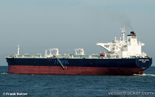
 MINERVA MARINA
Current Status
Where is the vessel?
MINERVA MARINA is currently in 84 nm E of Rodanthe, based on AIS data received less than 1h ago.
Latest AIS update:
Current position: 35.31330° N, 73.77500° W (84 nm E of Rodanthe)
Average speed (last 7 days): Loading…
Average speed (last 30 days): Loading…
Vessel profile: MINERVA MARINA is a Crude Oil Tanker with dimensions 48m x 273m.
This page combines live AIS, route history, probable destination signals, nearby traffic, and port activity for practical vessel monitoring.
The current position of vessel MINERVA MARINA is 35.3133 lat / -73.775 lng. Updated: 2026-04-26 05:33:41 UTCNearest reference points:
- 91 nm E of Rodanthe
- 48 nm E of Nags Head
- 45 nm NE of Nags Head
Currently sailing under the flag of Malta ![]()
MINERVA MARINA built in 2009 year
Deadweight:
157954 tDetails:
Live Vessel MINERVA MARINA Analytics (details, animations, etc.)
Recent AIS points (UTC):
2026-04-26 01:27:44 UTC · 34.60500, -74.66170 · SOG 14 kn · COG -1°2026-04-26 03:24:43 UTC · 34.94830, -74.25830 · SOG 14 kn · COG -1°
2026-04-26 04:03:42 UTC · 35.05670, -74.11330 · SOG 14 kn · COG -1°
2026-04-26 05:33:41 UTC · 35.31330, -73.77500 · SOG 15 kn · COG -1°