 vesseltracker.com
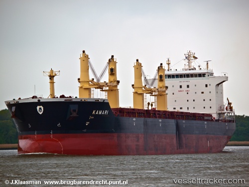
Mv Kamari
Current StatusWhere is the vessel?
Mv Kamari is currently in Near KO SICHANG, based on AIS data received less than 1h ago.
Latest AIS update:
Current position: 13.18297° N, 100.83758° E (Near KO SICHANG)
Average speed (last 7 days): Loading…
Average speed (last 30 days): Loading…
Vessel profile: Mv Kamari is a Bulk Carrier with dimensions 32m x 190m.
This page combines live AIS, route history, probable destination signals, nearby traffic, and port activity for practical vessel monitoring.
The current position of vessel Mv Kamari is 13.18297 lat / 100.83758 lng. Updated: 2026-05-16 02:15:43 UTCNearest reference points:
- Near Sriracha
- Near KO SICHANG
- Near SIRACHA
Details:
Live Vessel Mv Kamari Analytics (details, animations, etc.)
Recent AIS points (UTC):
2026-05-15 23:04:36 UTC · 13.18294, 100.83758 · SOG 0 kn · COG 359°2026-05-15 23:58:42 UTC · 13.18292, 100.83752 · SOG 0 kn · COG 1°
2026-05-16 01:10:44 UTC · 13.18295, 100.83745 · SOG 0 kn · COG 5°
2026-05-16 02:15:43 UTC · 13.18297, 100.83758 · SOG 0 kn · COG 356°