 vesseltracker.com
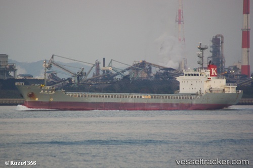
 Mitsukawa Maru
Current Status
Where is the vessel?
Mitsukawa Maru is currently in Near SUSAKI, based on AIS data received about 6h ago.
Latest AIS update:
Current position: 33.30271° N, 133.39891° E (Near SUSAKI)
Average speed (last 7 days): Loading…
Average speed (last 30 days): Loading…
Vessel profile: Mitsukawa Maru is a Limestone Carrier with dimensions 105m x 105m.
This page combines live AIS, route history, probable destination signals, nearby traffic, and port activity for practical vessel monitoring.
The current position of vessel Mitsukawa Maru is 33.30271 lat / 133.39891 lng. Updated: 2026-05-14 16:04:20 UTCNearest reference points:
- Near Kochi
- Near NYUGAWA
- Near Yoshiumi
Currently sailing under the flag of Japan ![]()
Details:
Live Vessel Mitsukawa Maru Analytics (details, animations, etc.)
Recent AIS points (UTC):
2026-05-14 16:04:20 UTC · 33.30271, 133.39891 · SOG 14 kn · COG 286°2026-05-14 16:04:20 UTC · 33.30271, 133.39891 · SOG 14 kn · COG 286°
2026-05-14 16:04:20 UTC · 33.30271, 133.39891 · SOG 14 kn · COG 286°
2026-05-14 16:04:20 UTC · 33.30271, 133.39891 · SOG 14 kn · COG 286°