 vesseltracker.com
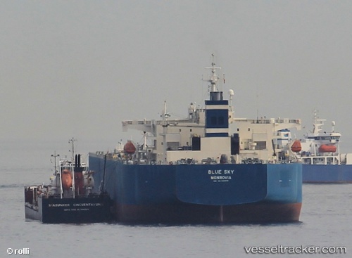
 Blue Sky
Current Status
Where is the vessel?
Blue Sky is currently in 26 nm SW of Freeport, based on AIS data received about 1h ago.
Latest AIS update:
Current position: 26.25513° N, 79.15940° W (26 nm SW of Freeport)
Average speed (last 7 days): Loading…
Average speed (last 30 days): Loading…
Vessel profile: Blue Sky is a Crude Oil Tanker with dimensions 229m x 42m.
This page combines live AIS, route history, probable destination signals, nearby traffic, and port activity for practical vessel monitoring.
The current position of vessel Blue Sky is 26.25513 lat / -79.15940 lng. Updated: 2026-05-14 02:14:54 UTCNearest reference points:
- 44 nm S of Freeport
- 44 nm E of Surfside
- Near Fort Lauderdale
Currently sailing under the flag of Liberia ![]()
Blue Sky built in 2009 year
Deadweight:
105491 tDetails:
Live Vessel Blue Sky Analytics (details, animations, etc.)
Recent AIS points (UTC):
2026-05-13 23:05:33 UTC · 25.67542, -79.47458 · SOG 13.3 kn · COG 18°2026-05-14 00:21:44 UTC · 25.94430, -79.39755 · SOG 13 kn · COG 18°
2026-05-14 01:39:44 UTC · 26.18625, -79.25868 · SOG 12.6 kn · COG 41°
2026-05-14 02:14:54 UTC · 26.25513, -79.15940 · SOG 12.1 kn · COG 94°