 vesseltracker.com
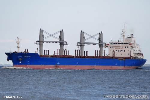
 BAM TRITON
Current Status
Where is the vessel?
BAM TRITON is currently in Near Ponta da Madeira, based on AIS data received about 1h ago.
Latest AIS update:
Current position: 2.58262° S, 44.36906° W (Near Ponta da Madeira)
Average speed (last 7 days): Loading…
Average speed (last 30 days): Loading…
Vessel profile: BAM TRITON is a Bulk Carrier with dimensions m x m.
This page combines live AIS, route history, probable destination signals, nearby traffic, and port activity for practical vessel monitoring.
The current position of vessel BAM TRITON is -2.58262 lat / -44.36906 lng. Updated: 2026-04-24 01:27:24 UTCNearest reference points:
- 53 nm N of Beija-Flor
Currently sailing under the flag of Marshall Islands ![]()
Details:
Live Vessel BAM TRITON Analytics (details, animations, etc.)
Recent AIS points (UTC):
2026-04-23 22:06:15 UTC · -2.58268, -44.36908 · SOG 0 kn · COG 350°2026-04-23 22:09:15 UTC · -2.58265, -44.36912 · SOG 0 kn · COG 350°
2026-04-23 23:36:15 UTC · -2.58260, -44.36912 · SOG 0 kn · COG 351°
2026-04-24 01:27:24 UTC · -2.58262, -44.36906 · SOG 0 kn · COG 350°