 vesseltracker.com
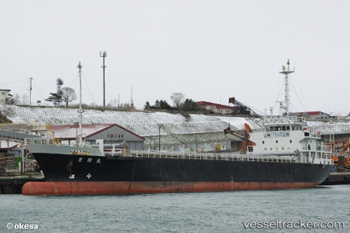
 RISUN 7
Current Status
Where is the vessel?
RISUN 7 is currently in 17 nm S of HAMAJIMA, based on AIS data received less than 1h ago.
Latest AIS update:
Current position: 34.02500° N, 136.68500° E (17 nm S of HAMAJIMA)
Average speed (last 7 days): Loading…
Average speed (last 30 days): Loading…
Vessel profile: RISUN 7 is a Cargo with dimensions m x m.
This page combines live AIS, route history, probable destination signals, nearby traffic, and port activity for practical vessel monitoring.
The current position of vessel RISUN 7 is 34.02500 lat / 136.68500 lng. Updated: 2026-05-14 03:32:17 UTCNearest reference points:
- 20 nm S of HAMAJIMA
- Near TOBA
- 12 nm E of TOBA
Currently sailing under the flag of Jamaica ![]()
Details:
Live Vessel RISUN 7 Analytics (details, animations, etc.)
Recent AIS points (UTC):
2026-05-14 00:03:34 UTC · 33.64643, 136.18286 · SOG 9.5 kn · COG 58°2026-05-14 01:42:20 UTC · 33.83427, 136.40958 · SOG 10 kn · COG 52°
2026-05-14 01:47:16 UTC · 33.84333, 136.42000 · SOG 9 kn · COG -1°
2026-05-14 03:32:17 UTC · 34.02500, 136.68500 · SOG 10 kn · COG -1°