 vesseltracker.com
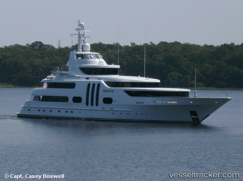
 Gallant Lady
Current Status
Where is the vessel?
Gallant Lady is currently in Near Port Everglades, based on AIS data received about 3h ago.
Latest AIS update:
Current position: 26.10292° N, 80.12020° W (Near Port Everglades)
Average speed (last 7 days): Loading…
Average speed (last 30 days): Loading…
Vessel profile: Gallant Lady is a Service Ship with dimensions 51m x 10m.
This page combines live AIS, route history, probable destination signals, nearby traffic, and port activity for practical vessel monitoring.
The current position of vessel Gallant Lady is 26.10292 lat / -80.12020 lng. Updated: 2026-05-14 23:30:30 UTCNearest reference points:
- Near Port Everglades
- Near Fort Lauderdale
- Near Dania Beach
Currently sailing under the flag of USA ![]()
Details:
Live Vessel Gallant Lady Analytics (details, animations, etc.)
Recent AIS points (UTC):
2026-05-14 19:45:26 UTC · 26.10292, -80.12018 · SOG 0 kn · COG 269°2026-05-14 21:48:29 UTC · 26.10291, -80.12018 · SOG 0 kn · COG 269°
2026-05-14 23:06:31 UTC · 26.10290, -80.12018 · SOG 0 kn · COG 269°
2026-05-14 23:30:30 UTC · 26.10292, -80.12020 · SOG 0 kn · COG 269°