 vesseltracker.com
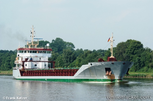
 Tina C
Current Status
Where is the vessel?
Tina C is currently in Near Agia Marina Aiginas, based on AIS data received less than 1h ago.
Latest AIS update:
Current position: 37.80758° N, 23.61499° E (Near Agia Marina Aiginas)
Average speed (last 7 days): Loading…
Average speed (last 30 days): Loading…
Vessel profile: Tina C is a General Cargo Ship with dimensions 100m x 15m.
This page combines live AIS, route history, probable destination signals, nearby traffic, and port activity for practical vessel monitoring.
The current position of vessel Tina C is 37.80758 lat / 23.61499 lng. Updated: 2026-05-14 16:09:11 UTCNearest reference points:
- Near ZEA
- Near ALIMOS
- Near Piraeus
Currently sailing under the flag of United Kingdom ![]()
Tina C built in 2008 year
Deadweight:
5664 tDetails:
Live Vessel Tina C Analytics (details, animations, etc.)
Recent AIS points (UTC):
2026-05-14 13:35:21 UTC · 37.88469, 23.10437 · SOG 9.9 kn · COG 99°2026-05-14 13:54:02 UTC · 37.87613, 23.16828 · SOG 9.8 kn · COG 99°
2026-05-14 16:04:18 UTC · 37.81696, 23.60496 · SOG 8.8 kn · COG 143°
2026-05-14 16:09:11 UTC · 37.80758, 23.61499 · SOG 9.1 kn · COG 140°