 vesseltracker.com
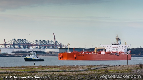
 Eagle Klang
Current Status
Where is the vessel?
Eagle Klang is currently in 34 nm W of Saint Lawrence, based on AIS data received less than 1h ago.
Latest AIS update:
Current position: 36.03425° N, 13.50136° E (34 nm W of Saint Lawrence)
Average speed (last 7 days): Loading…
Average speed (last 30 days): Loading…
Vessel profile: Eagle Klang is a Crude Oil Tanker with dimensions 243m x 42m.
This page combines live AIS, route history, probable destination signals, nearby traffic, and port activity for practical vessel monitoring.
The current position of vessel Eagle Klang is 36.03425 lat / 13.50136 lng. Updated: 2026-05-14 17:22:09 UTCNearest reference points:
- Near CIRKEWWA
- Near Saint Julians
- Near Sliema
Currently sailing under the flag of Singapore ![]()
Eagle Klang built in 2010 year
Deadweight:
107481 tDetails:
Live Vessel Eagle Klang Analytics (details, animations, etc.)
Recent AIS points (UTC):
2026-05-14 13:43:59 UTC · 36.61702, 12.79523 · SOG 13 kn · COG 140°2026-05-14 15:31:57 UTC · 36.32667, 13.13833 · SOG 13 kn · COG -1°
2026-05-14 15:31:57 UTC · 36.32667, 13.13833 · SOG 13 kn · COG -1°
2026-05-14 17:22:09 UTC · 36.03425, 13.50136 · SOG 13.3 kn · COG 136°