 SPIL CAYA
Current Status
Where is the vessel?
SPIL CAYA is currently in 16 nm SE of Hithadhoo, based on AIS data received about 14h ago.
Latest AIS update:
Current position: 1.54794° N, 73.51776° E (16 nm SE of Hithadhoo)
Average speed (last 7 days): Loading…
Average speed (last 30 days): Loading…
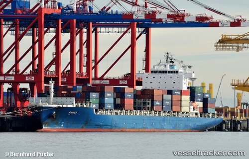
Vessel profile: SPIL CAYA is a Container Ship with dimensions 231m x 231m.
This page combines live AIS, route history, probable destination signals, nearby traffic, and port activity for practical vessel monitoring.
The current position of vessel SPIL CAYA is 1.54794 lat / 73.51776 lng. Updated: 2026-05-23 13:35:33 UTCNearest reference points:
- Near Maamigili Port
- 146 nm E of Koodoo Fisheries
Currently sailing under the flag of Panama ![]()
SPIL CAYA built in 2009 year
Deadweight:
41982 tDetails:
Live Vessel SPIL CAYA Analytics (details, animations, etc.)
Recent AIS points (UTC):
2026-05-23 10:00:51 UTC · 1.23006, 72.35951 · SOG 19.8 kn · COG 74°2026-05-23 11:09:00 UTC · 1.33122, 72.72047 · SOG 20.1 kn · COG 74°
2026-05-23 13:26:03 UTC · 1.53383, 73.46483 · SOG 20.8 kn · COG 74°
2026-05-23 13:35:33 UTC · 1.54794, 73.51776 · SOG 20.7 kn · COG 74°