 vesseltracker.com
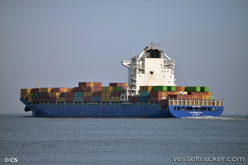
 LISA
LISA
Current Status
Where is the vessel?
LISA is currently in 25 nm E of Ceuta, based on AIS data received about 2h ago.
Latest AIS update:
Current position: 35.92227° N, 4.79534° W (25 nm E of Ceuta)
Average speed (last 7 days): Loading…
Average speed (last 30 days): Loading…
Vessel profile: LISA is a Container Ship with dimensions 32m x 260m.
This page combines live AIS, route history, probable destination signals, nearby traffic, and port activity for practical vessel monitoring.
The current position of vessel LISA is 35.92227 lat / -4.79534 lng. Updated: 2026-05-15 01:14:13 UTCNearest reference points:
- 30 nm E of Ceuta
- Near Waterport
- Near Nueva Andalucia
Currently sailing under the flag of Liberia ![]()
LISA built in 2009 year
Deadweight:
49994 tDetails:
Live Vessel LISA Analytics (details, animations, etc.)
Recent AIS points (UTC):
2026-05-14 22:22:23 UTC · 35.58712, -4.36320 · SOG 10.5 kn · COG 312°2026-05-14 22:57:43 UTC · 35.65459, -4.46138 · SOG 10.8 kn · COG 309°
2026-05-14 23:47:12 UTC · 35.74964, -4.59138 · SOG 10.2 kn · COG 309°
2026-05-15 01:14:13 UTC · 35.92227, -4.79534 · SOG 8.6 kn · COG 303°