 vesseltracker.com
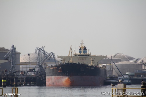
 Mt Leo
Current Status
Where is the vessel?
Mt Leo is currently in Near Ocean Grove, based on AIS data received about 107d ago.
Latest AIS update:
Current position: 38.34406° S, 144.58717° E (Near Ocean Grove)
Average speed (last 7 days): Loading…
Average speed (last 30 days): Loading…
Vessel profile: Mt Leo is a Crude Oil Tanker with dimensions 250m x 250m.
This page combines live AIS, route history, probable destination signals, nearby traffic, and port activity for practical vessel monitoring.
The current position of vessel Mt Leo is -38.34406 lat / 144.58717 lng. Updated: 2026-01-13 11:40:22 UTCNearest reference points:
- Near QUEENSCLIFF
- Near Drysdale
- Near Geelong North
Currently sailing under the flag of Liberia ![]()
Mt Leo built in 2010 year
Deadweight:
112795 tDetails:
Live Vessel Mt Leo Analytics (details, animations, etc.)
Recent AIS points (UTC):
2026-01-13 11:40:22 UTC · -38.34406, 144.58717 · SOG 15.7 kn · COG 20°