 vesseltracker.com
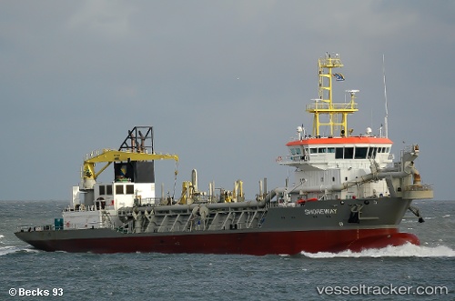
Shoreway
Current StatusWhere is the vessel?
Shoreway is currently in Near Kpeme, based on AIS data received about 1h ago.
Latest AIS update:
Current position: 6.11690° N, 1.46170° E (Near Kpeme)
Average speed (last 7 days): Loading…
Average speed (last 30 days): Loading…
Vessel profile: Shoreway is a Hopper Dredger with dimensions 22m x 98m.
This page combines live AIS, route history, probable destination signals, nearby traffic, and port activity for practical vessel monitoring.
The current position of vessel Shoreway is 6.11690 lat / 1.46170 lng. Updated: 2026-05-15 19:44:27 UTCNearest reference points:
- Near Ablogamé
- Near Cotonou
- Near Kirikiri
Details:
Live Vessel Shoreway Analytics (details, animations, etc.)
Recent AIS points (UTC):
2026-05-15 16:35:27 UTC · 6.11692, 1.46177 · SOG 0.5 kn · COG 200°2026-05-15 17:44:27 UTC · 6.11688, 1.46171 · SOG 0.4 kn · COG 195°
2026-05-15 19:02:27 UTC · 6.11687, 1.46175 · SOG 0.1 kn · COG 206°
2026-05-15 19:44:27 UTC · 6.11690, 1.46170 · SOG 0.3 kn · COG 213°