 vesseltracker.com
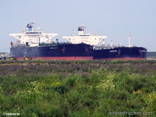
 SEA VALIANT
Current Status
Where is the vessel?
SEA VALIANT is currently in 97 nm NW of ABU QIR, based on AIS data received less than 1h ago.
Latest AIS update:
Current position: 32.80538° N, 29.32173° E (97 nm NW of ABU QIR)
Average speed (last 7 days): Loading…
Average speed (last 30 days): Loading…
Vessel profile: SEA VALIANT is a Crude Oil Tanker with dimensions 244m x 42m.
This page combines live AIS, route history, probable destination signals, nearby traffic, and port activity for practical vessel monitoring.
The current position of vessel SEA VALIANT is 32.80538 lat / 29.32173 lng. Updated: 2026-05-16 08:25:07 UTCNearest reference points:
- 129 nm NW of ABU QIR
- 28 nm N of Hamra
- 108 nm S of Kastellorizou (ex Megísti)
Currently sailing under the flag of Marshall Islands ![]()
SEA VALIANT built in 2010 year
Deadweight:
107488 tDetails:
Live Vessel SEA VALIANT Analytics (details, animations, etc.)
Recent AIS points (UTC):
2026-05-16 07:26:06 UTC · 32.74500, 29.54667 · SOG 12 kn · COG -1°2026-05-16 07:26:06 UTC · 32.74500, 29.54667 · SOG 12 kn · COG -1°
2026-05-16 08:25:07 UTC · 32.80538, 29.32173 · SOG 12.2 kn · COG 292°
2026-05-16 08:25:07 UTC · 32.80538, 29.32173 · SOG 12.2 kn · COG 292°