 vesseltracker.com
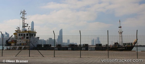
Hamdah 1
Current StatusWhere is the vessel?
Hamdah 1 is currently in 61 nm NE of Mitsiwa, based on AIS data received about 455d ago.
Latest AIS update:
Current position: 16.34883° N, 40.21846° E (61 nm NE of Mitsiwa)
Average speed (last 7 days): Loading…
Average speed (last 30 days): Loading…
Vessel profile: Hamdah 1 is a Landing Craft with dimensions 20m x 47m.
This page combines live AIS, route history, probable destination signals, nearby traffic, and port activity for practical vessel monitoring.
The current position of vessel Hamdah 1 is 16.34883 lat / 40.21846 lng. Updated: 2025-02-13 14:41:37 UTCNearest reference points:
- 92 nm SW of Al Qahmah
- 81 nm NW of As Salif
- Near Jazan Economic City
Details:
Live Vessel Hamdah 1 Analytics (details, animations, etc.)
Recent AIS points (UTC):
2025-02-13 14:41:37 UTC · 16.34883, 40.21846 · SOG 0.1 kn · COG -1°