 vesseltracker.com
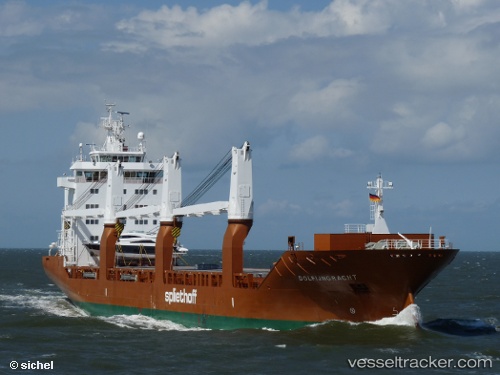
 Dolfijngracht
Current Status
Where is the vessel?
Dolfijngracht is currently in 22 nm W of Aguçadoura, based on AIS data received less than 1h ago.
Latest AIS update:
Current position: 41.37158° N, 9.26975° W (22 nm W of Aguçadoura)
Average speed (last 7 days): Loading…
Average speed (last 30 days): Loading…
Vessel profile: Dolfijngracht is a General Cargo Ship with dimensions 157m x 23m.
This page combines live AIS, route history, probable destination signals, nearby traffic, and port activity for practical vessel monitoring.
The current position of vessel Dolfijngracht is 41.37158 lat / -9.26975 lng. Updated: 2026-04-28 10:09:19 UTCNearest reference points:
- Near POVOA DE VARZIM
- Near Matosinhos
- 11 nm S of Sarinena
Currently sailing under the flag of Netherlands ![]()
Dolfijngracht built in 2009 year
Deadweight:
17967 tDetails:
Live Vessel Dolfijngracht Analytics (details, animations, etc.)
Recent AIS points (UTC):
2026-04-28 07:29:17 UTC · 41.94833, -9.65333 · SOG 15 kn · COG -1°2026-04-28 07:32:15 UTC · 41.93667, -9.64500 · SOG 15 kn · COG -1°
2026-04-28 09:42:55 UTC · 41.46927, -9.32827 · SOG 14.5 kn · COG 156°
2026-04-28 10:09:19 UTC · 41.37158, -9.26975 · SOG 14.3 kn · COG 155°