 vesseltracker.com
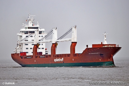
 Donaugracht
Current Status
Where is the vessel?
Donaugracht is currently in 310 nm N of ANEGADA, based on AIS data received about 1h ago.
Latest AIS update:
Current position: 23.87925° N, 64.46436° W (310 nm N of ANEGADA)
Average speed (last 7 days): Loading…
Average speed (last 30 days): Loading…
Vessel profile: Donaugracht is a General Cargo Ship with dimensions 157m x 23m.
This page combines live AIS, route history, probable destination signals, nearby traffic, and port activity for practical vessel monitoring.
The current position of vessel Donaugracht is 23.87925 lat / -64.46436 lng. Updated: 2026-05-13 17:15:54 UTCNearest reference points:
- 361 nm W of Villa Elisa
- Open sea, approx. 429 nm off the nearest listed port
- Open sea, approx. 426 nm off the nearest listed port
Currently sailing under the flag of Netherlands ![]()
Donaugracht built in 2009 year
Deadweight:
17967 tDetails:
Live Vessel Donaugracht Analytics (details, animations, etc.)
Recent AIS points (UTC):
2026-05-13 13:43:52 UTC · 23.27167, -63.97167 · SOG 12 kn · COG -1°2026-05-13 15:52:52 UTC · 23.64167, -64.27167 · SOG 13 kn · COG -1°
2026-05-13 17:01:53 UTC · 23.84166, -64.43500 · SOG 12 kn · COG -1°
2026-05-13 17:15:54 UTC · 23.87925, -64.46436 · SOG 6.5 kn · COG 322°