 vesseltracker.com
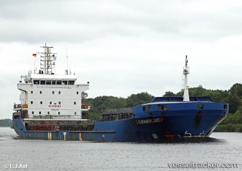
 Manisa Kate
Current Status
Where is the vessel?
Manisa Kate is currently in Near FIGUEIRA DA FOZ, based on AIS data received about 1h ago.
Latest AIS update:
Current position: 40.14650° N, 8.84541° W (Near FIGUEIRA DA FOZ)
Average speed (last 7 days): Loading…
Average speed (last 30 days): Loading…
Vessel profile: Manisa Kate is a Multi Purpose Carrier with dimensions 108m x 18m.
This page combines live AIS, route history, probable destination signals, nearby traffic, and port activity for practical vessel monitoring.
The current position of vessel Manisa Kate is 40.14650 lat / -8.84541 lng. Updated: 2026-04-27 15:36:21 UTCNearest reference points:
- Near Figuera Da Foz
- Near Gafanha da Nazaré
- Near Nazaré
Currently sailing under the flag of Netherlands ![]()
Manisa Kate built in 2008 year
Deadweight:
8100 tDetails:
Live Vessel Manisa Kate Analytics (details, animations, etc.)
Recent AIS points (UTC):
2026-04-27 10:07:33 UTC · 40.15050, -8.94842 · SOG 0.1 kn · COG 324°2026-04-27 11:58:31 UTC · 40.15051, -8.94825 · SOG 0 kn · COG 322°
2026-04-27 13:44:07 UTC · 40.14284, -8.87602 · SOG 9 kn · COG 44°
2026-04-27 15:36:21 UTC · 40.14650, -8.84541 · SOG 0 kn · COG 277°