 vesseltracker.com
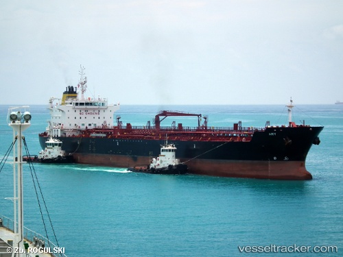
 CAPE CORFU
Current Status
Where is the vessel?
CAPE CORFU is currently in Near Soliman, based on AIS data received less than 1h ago.
Latest AIS update:
Current position: 36.80786° N, 10.50180° E (Near Soliman)
Average speed (last 7 days): Loading…
Average speed (last 30 days): Loading…
Vessel profile: CAPE CORFU is a Chemical/Oil Products Tanker with dimensions 183m x 27m.
This page combines live AIS, route history, probable destination signals, nearby traffic, and port activity for practical vessel monitoring.
The current position of vessel CAPE CORFU is 36.80786 lat / 10.50180 lng. Updated: 2026-03-29 23:42:26 UTCNearest reference points:
- Near Le Kram
- 13 nm N of Qulaybiyah
- 32 nm N of Qulaybiyah
Currently sailing under the flag of Liberia ![]()
CAPE CORFU built in 2009 year
Deadweight:
37759 tDetails:
Live Vessel CAPE CORFU Analytics (details, animations, etc.)
Recent AIS points (UTC):
2026-03-29 18:19:15 UTC · 36.80720, 10.50124 · SOG 0.1 kn · COG 328°2026-03-29 20:11:57 UTC · 36.80732, 10.50136 · SOG 0 kn · COG 321°
2026-03-29 21:28:56 UTC · 36.80754, 10.50160 · SOG 0.1 kn · COG 309°
2026-03-29 23:42:26 UTC · 36.80786, 10.50180 · SOG 0.1 kn · COG 298°