 vesseltracker.com
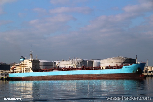
Karen Maersk
Current StatusWhere is the vessel?
Karen Maersk is currently in Near Milazzo, based on AIS data received less than 1h ago.
Latest AIS update:
Current position: 38.21116° N, 15.26369° E (Near Milazzo)
Average speed (last 7 days): Loading…
Average speed (last 30 days): Loading…
Vessel profile: Karen Maersk is a Chemical Oil Products Tanker with dimensions 27m x 183m.
This page combines live AIS, route history, probable destination signals, nearby traffic, and port activity for practical vessel monitoring.
The current position of vessel Karen Maersk is 38.21116 lat / 15.26369 lng. Updated: 2026-05-16 05:31:12 UTCNearest reference points:
- Near Milazzo
- 13 nm N of Rometta Marea
- Near TREMESTIERI
Details:
Live Vessel Karen Maersk Analytics (details, animations, etc.)
Recent AIS points (UTC):
2026-05-16 01:49:12 UTC · 38.21113, 15.26366 · SOG 0 kn · COG 10°2026-05-16 03:22:12 UTC · 38.21113, 15.26367 · SOG 0 kn · COG 10°
2026-05-16 04:04:12 UTC · 38.21119, 15.26367 · SOG 0.1 kn · COG 10°
2026-05-16 05:31:12 UTC · 38.21116, 15.26369 · SOG 0 kn · COG 10°