 vesseltracker.com
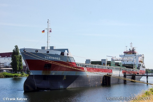
 Eemsborg
Current Status
Where is the vessel?
Eemsborg is currently in Near Oxelosund, based on AIS data received less than 1h ago.
Latest AIS update:
Current position: 58.67500° N, 17.13717° E (Near Oxelosund)
Average speed (last 7 days): Loading…
Average speed (last 30 days): Loading…
Vessel profile: Eemsborg is a General Cargo Ship with dimensions 138m x 16m.
This page combines live AIS, route history, probable destination signals, nearby traffic, and port activity for practical vessel monitoring.
The current position of vessel Eemsborg is 58.67500 lat / 17.13717 lng. Updated: 2026-05-14 10:41:14 UTCNearest reference points:
- Near Krokek
- Near Stora Vika
- Near SODERTALJE
Currently sailing under the flag of Netherlands ![]()
Eemsborg built in 2009 year
Deadweight:
10750 tDetails:
Live Vessel Eemsborg Analytics (details, animations, etc.)
Recent AIS points (UTC):
2026-05-14 07:59:11 UTC · 58.67500, 17.13717 · SOG 0 kn · COG 341°2026-05-14 08:23:09 UTC · 58.67500, 17.13717 · SOG 0 kn · COG 342°
2026-05-14 10:11:14 UTC · 58.67500, 17.13717 · SOG 0 kn · COG 342°
2026-05-14 10:41:14 UTC · 58.67500, 17.13717 · SOG 0 kn · COG 341°