 vesseltracker.com
 Parkgracht
Current Status
Where is the vessel?
Parkgracht is currently in 19 nm SE of CARBONERAS, based on AIS data received about 1h ago.
Latest AIS update:
Current position: 36.68697° N, 1.71436° W (19 nm SE of CARBONERAS)
Average speed (last 7 days): Loading…
Average speed (last 30 days): Loading…
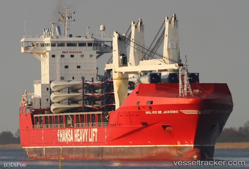
Vessel profile: Parkgracht is a Heavy Load Carrier with dimensions 168m x 25m.
This page combines live AIS, route history, probable destination signals, nearby traffic, and port activity for practical vessel monitoring.
The current position of vessel Parkgracht is 36.68697 lat / -1.71436 lng. Updated: 2026-05-02 20:06:21 UTCNearest reference points:
- 20 nm SE of CARBONERAS
- 27 nm SE of El Alquian
- 26 nm S of El Alquian
Currently sailing under the flag of Netherlands ![]()
Parkgracht built in 2009 year
Deadweight:
20170 tDetails:
Live Vessel Parkgracht Analytics (details, animations, etc.)
Recent AIS points (UTC):
2026-05-02 16:51:47 UTC · 37.09796, -0.79600 · SOG 15.3 kn · COG 237°2026-05-02 17:34:43 UTC · 36.99667, -0.99167 · SOG 15 kn · COG -1°
2026-05-02 19:04:32 UTC · 36.80512, -1.41362 · SOG 15.3 kn · COG 238°
2026-05-02 20:06:21 UTC · 36.68697, -1.71436 · SOG 15.6 kn · COG 247°