 vesseltracker.com
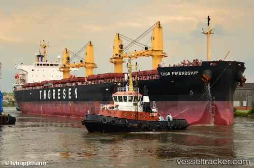
Thor Friendship
Current StatusWhere is the vessel?
Thor Friendship is currently in 39 nm NW of Buenaventura, based on AIS data received less than 1h ago.
Latest AIS update:
Current position: 4.17013° N, 77.65903° W (39 nm NW of Buenaventura)
Average speed (last 7 days): Loading…
Average speed (last 30 days): Loading…
Vessel profile: Thor Friendship is a Bulk Carrier with dimensions 32m x 190m.
This page combines live AIS, route history, probable destination signals, nearby traffic, and port activity for practical vessel monitoring.
The current position of vessel Thor Friendship is 4.17013 lat / -77.65903 lng. Updated: 2026-05-14 16:21:12 UTCNearest reference points:
- 33 nm W of Buenaventura
- Near Buenaventura
Details:
Live Vessel Thor Friendship Analytics (details, animations, etc.)
Recent AIS points (UTC):
2026-05-14 11:11:52 UTC · 4.99922, -78.07343 · SOG 10.5 kn · COG 159°2026-05-14 13:32:52 UTC · 4.62091, -77.88269 · SOG 10.7 kn · COG 155°
2026-05-14 14:10:08 UTC · 4.52048, -77.83621 · SOG 10.5 kn · COG 155°
2026-05-14 16:21:12 UTC · 4.17013, -77.65903 · SOG 10.8 kn · COG 152°