 vesseltracker.com
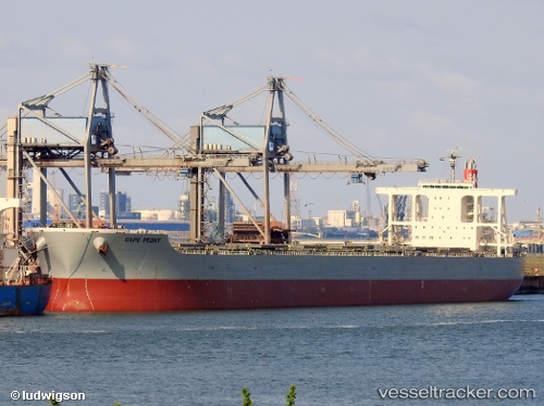
 Cape Peony
Current Status
Where is the vessel?
Cape Peony is currently in 79 nm SW of Dokdo, based on AIS data received less than 1h ago.
Latest AIS update:
Current position: 36.01571° N, 131.22359° E (79 nm SW of Dokdo)
Average speed (last 7 days): Loading…
Average speed (last 30 days): Loading…
Vessel profile: Cape Peony is a Bulk Carrier with dimensions 292m x 292m.
This page combines live AIS, route history, probable destination signals, nearby traffic, and port activity for practical vessel monitoring.
The current position of vessel Cape Peony is 36.01571 lat / 131.22359 lng. Updated: 2026-05-13 20:55:48 UTCNearest reference points:
- 67 nm W of NAKANOSHIMA
- 63 nm NW of Unnan
- 39 nm N of Iwami
Currently sailing under the flag of Panama ![]()
Cape Peony built in 2012 year
Deadweight:
181325 tDetails:
Live Vessel Cape Peony Analytics (details, animations, etc.)
Recent AIS points (UTC):
2026-05-13 17:20:29 UTC · 36.37192, 131.79498 · SOG 9.9 kn · COG 231°2026-05-13 19:03:59 UTC · 36.19796, 131.51631 · SOG 9.8 kn · COG 232°
2026-05-13 19:57:19 UTC · 36.11335, 131.37262 · SOG 9.7 kn · COG 233°
2026-05-13 20:55:48 UTC · 36.01571, 131.22359 · SOG 9.6 kn · COG 232°