 vesseltracker.com
 STAR LAPIS
Current Status
Where is the vessel?
STAR LAPIS is currently in 114 nm SW of Port Etienne, based on AIS data received about 1h ago.
Latest AIS update:
Current position: 19.73500° N, 18.83267° W (114 nm SW of Port Etienne)
Average speed (last 7 days): Loading…
Average speed (last 30 days): Loading…
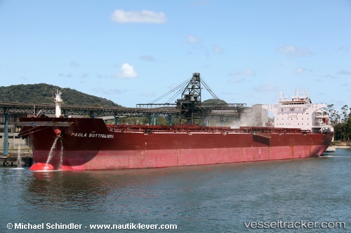
Vessel profile: STAR LAPIS is a Bulk Carrier with dimensions 38m x 229m.
This page combines live AIS, route history, probable destination signals, nearby traffic, and port activity for practical vessel monitoring.
The current position of vessel STAR LAPIS is 19.73500 lat / -18.83267 lng. Updated: 2026-05-16 17:47:50 UTCNearest reference points:
- 108 nm SW of Port Etienne
- 119 nm W of Nouakchott
- 96 nm NW of Nouakchott
Currently sailing under the flag of Bahamas ![]()
STAR LAPIS built in 2010 year
Deadweight:
93262 tDetails:
Live Vessel STAR LAPIS Analytics (details, animations, etc.)
Recent AIS points (UTC):
2026-05-16 12:38:49 UTC · 18.96850, -19.24950 · SOG 9.6 kn · COG 26°2026-05-16 14:44:01 UTC · 19.27717, -19.09016 · SOG 10 kn · COG 30°
2026-05-16 16:40:50 UTC · 19.56133, -18.92083 · SOG 10 kn · COG 30°
2026-05-16 17:47:50 UTC · 19.73500, -18.83267 · SOG 10.1 kn · COG 28°