 vesseltracker.com
 LUNA ROSSA
Current Status
Where is the vessel?
LUNA ROSSA is currently in 335 nm SE of Abakaliki, based on AIS data received about 2h ago.
Latest AIS update:
Current position: 1.70567° N, 89.11298° E (335 nm SE of Abakaliki)
Average speed (last 7 days): Loading…
Average speed (last 30 days): Loading…
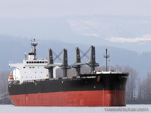
Vessel profile: LUNA ROSSA is a Bulk Carrier with dimensions 32m x 200m.
This page combines live AIS, route history, probable destination signals, nearby traffic, and port activity for practical vessel monitoring.
The current position of vessel LUNA ROSSA is 1.70567 lat / 89.11298 lng. Updated: 2026-05-01 02:30:49 UTCNearest reference points:
- Open sea, approx. 401 nm off the nearest listed port
- Open sea, approx. 402 nm off the nearest listed port
- Open sea, approx. 403 nm off the nearest listed port
Currently sailing under the flag of Liberia ![]()
LUNA ROSSA built in 2010 year
Deadweight:
61645 tDetails:
Live Vessel LUNA ROSSA Analytics (details, animations, etc.)
Recent AIS points (UTC):
2026-04-30 23:58:27 UTC · 1.41864, 88.73939 · SOG 11.2 kn · COG 52°2026-05-01 02:11:25 UTC · 1.66842, 89.06590 · SOG 11.1 kn · COG 55°
2026-05-01 02:30:49 UTC · 1.70567, 89.11298 · SOG 11.2 kn · COG 55°
2026-05-01 02:30:49 UTC · 1.70567, 89.11298 · SOG 11.2 kn · COG 55°