 vesseltracker.com
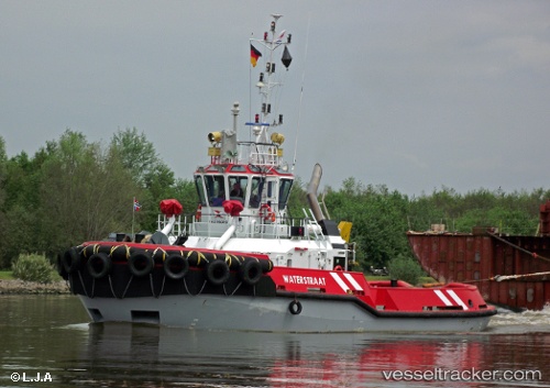
 Waterstraat
Current Status
Where is the vessel?
Waterstraat is currently in Near EEMSHAVEN, based on AIS data received about 1d ago.
Latest AIS update:
Current position: 53.44498° N, 6.82384° E (Near EEMSHAVEN)
Average speed (last 7 days): Loading…
Average speed (last 30 days): Loading…
Vessel profile: Waterstraat is a Tug with dimensions 31m x 10m.
This page combines live AIS, route history, probable destination signals, nearby traffic, and port activity for practical vessel monitoring.
The current position of vessel Waterstraat is 53.44498 lat / 6.82384 lng. Updated: 2026-04-10 07:27:46 UTCNearest reference points:
- Near Borkum
- Near APPINGEDAM
- Near Kolham
Currently sailing under the flag of Netherlands ![]()
Waterstraat built in 2008 year
Deadweight:
149 tDetails:
Live Vessel Waterstraat Analytics (details, animations, etc.)
Recent AIS points (UTC):
2026-04-10 02:24:06 UTC · 53.50189, 6.79492 · SOG 2.5 kn · COG -1°2026-04-10 03:49:26 UTC · 53.44346, 6.84951 · SOG 0.8 kn · COG -1°
2026-04-10 05:58:05 UTC · 53.44503, 6.82379 · SOG 0 kn · COG -1°
2026-04-10 07:27:46 UTC · 53.44498, 6.82384 · SOG 0 kn · COG -1°