 vesseltracker.com
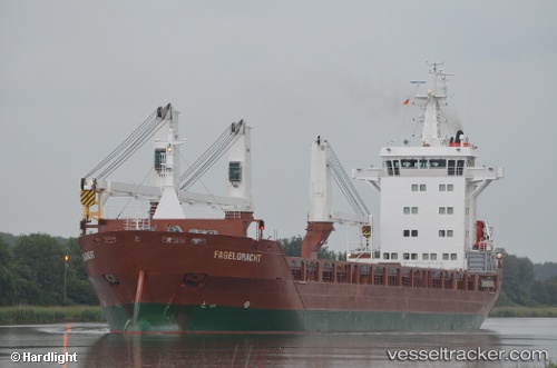
 Fagelgracht
Current Status
Where is the vessel?
Fagelgracht is currently in 64 nm E of Saint Lucie, based on AIS data received about 6h ago.
Latest AIS update:
Current position: 27.87536° N, 79.21414° W (64 nm E of Saint Lucie)
Average speed (last 7 days): Loading…
Average speed (last 30 days): Loading…
Vessel profile: Fagelgracht is a General Cargo Ship with dimensions 136m x 136m.
This page combines live AIS, route history, probable destination signals, nearby traffic, and port activity for practical vessel monitoring.
The current position of vessel Fagelgracht is 27.87536 lat / -79.21414 lng. Updated: 2026-05-02 14:24:58 UTCNearest reference points:
- Near Saint Lucie
- 27 nm NE of Port Canaveral
- Near Juno Beach
Currently sailing under the flag of Netherlands ![]()
Fagelgracht built in 2011 year
Deadweight:
12500 tDetails:
Live Vessel Fagelgracht Analytics (details, animations, etc.)
Recent AIS points (UTC):
2026-05-02 14:24:58 UTC · 27.87536, -79.21414 · SOG 11.5 kn · COG 39°2026-05-02 14:24:58 UTC · 27.87536, -79.21414 · SOG 11.5 kn · COG 39°
2026-05-02 14:24:58 UTC · 27.87536, -79.21414 · SOG 11.5 kn · COG 39°
2026-05-02 14:24:58 UTC · 27.87536, -79.21414 · SOG 11.5 kn · COG 39°