 vesseltracker.com
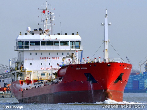
 Bomar Mercury
Current Status
Where is the vessel?
Bomar Mercury is currently in Near SLUISKIL, based on AIS data received less than 1h ago.
Latest AIS update:
Current position: 51.27326° N, 3.83686° E (Near SLUISKIL)
Average speed (last 7 days): Loading…
Average speed (last 30 days): Loading…
Vessel profile: Bomar Mercury is a Chemical Oil Products Tanker with dimensions 120m x 120m.
This page combines live AIS, route history, probable destination signals, nearby traffic, and port activity for practical vessel monitoring.
The current position of vessel Bomar Mercury is 51.27326 lat / 3.83686 lng. Updated: 2026-05-15 13:24:54 UTCNearest reference points:
- Near SLUISKIL
- Near Terneuzen
- Near Baarland
Currently sailing under the flag of Malta ![]()
Bomar Mercury built in 2008 year
Deadweight:
7003 tDetails:
Live Vessel Bomar Mercury Analytics (details, animations, etc.)
Recent AIS points (UTC):
2026-05-15 10:15:54 UTC · 51.27324, 3.83688 · SOG 0 kn · COG 22°2026-05-15 11:42:59 UTC · 51.27325, 3.83688 · SOG 0 kn · COG 22°
2026-05-15 13:06:57 UTC · 51.27325, 3.83686 · SOG 0 kn · COG 22°
2026-05-15 13:24:54 UTC · 51.27326, 3.83686 · SOG 0 kn · COG 22°