 vesseltracker.com
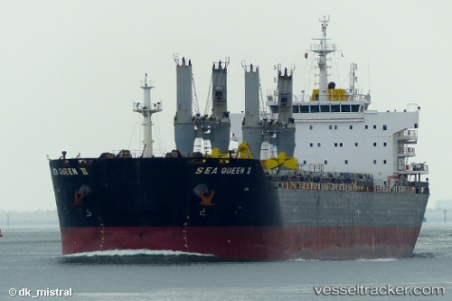
 SEA QUEEN II
Current Status
Where is the vessel?
SEA QUEEN II is currently in 90 nm W of Gizan, based on AIS data received less than 1h ago.
Latest AIS update:
Current position: 16.55685° N, 40.87041° E (90 nm W of Gizan)
Average speed (last 7 days): Loading…
Average speed (last 30 days): Loading…
Vessel profile: SEA QUEEN II is a Bulk Carrier with dimensions m x m.
This page combines live AIS, route history, probable destination signals, nearby traffic, and port activity for practical vessel monitoring.
The current position of vessel SEA QUEEN II is 16.55685 lat / 40.87041 lng. Updated: 2026-04-30 17:49:02 UTCNearest reference points:
- 92 nm SW of Al Qahmah
- 81 nm NW of As Salif
- Near Jazan Economic City
Currently sailing under the flag of Malta ![]()
Details:
Live Vessel SEA QUEEN II Analytics (details, animations, etc.)
Recent AIS points (UTC):
2026-04-30 12:50:51 UTC · 15.78206, 41.45368 · SOG 10.9 kn · COG 324°2026-04-30 16:01:47 UTC · 16.26988, 41.08482 · SOG 11.7 kn · COG 319°
2026-04-30 16:18:56 UTC · 16.31447, 41.04798 · SOG 11.8 kn · COG 318°
2026-04-30 17:49:02 UTC · 16.55685, 40.87041 · SOG 12 kn · COG 321°