 vesseltracker.com
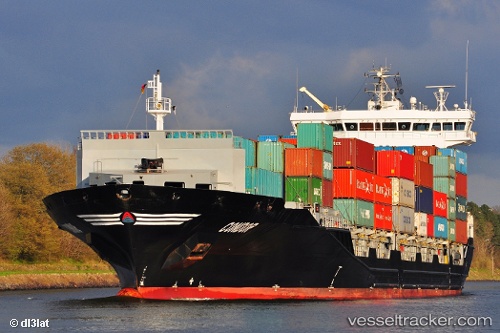
 TUNADAL
Current Status
Where is the vessel?
TUNADAL is currently in Near ROTTERDAM PERNIS, based on AIS data received less than 1h ago.
Latest AIS update:
Current position: 51.88003° N, 4.40300° E (Near ROTTERDAM PERNIS)
Average speed (last 7 days): Loading…
Average speed (last 30 days): Loading…
Vessel profile: TUNADAL is a Container Ship with dimensions 158m x 158m.
This page combines live AIS, route history, probable destination signals, nearby traffic, and port activity for practical vessel monitoring.
The current position of vessel TUNADAL is 51.88003 lat / 4.40300 lng. Updated: 2026-05-14 17:21:21 UTCNearest reference points:
- Near ROTTERDAM PERNIS
- Near Heijplaat
- Near ROTTERDAM WAALHAVEN
Currently sailing under the flag of Liberia ![]()
TUNADAL built in 2012 year
Deadweight:
14740 tDetails:
Live Vessel TUNADAL Analytics (details, animations, etc.)
Recent AIS points (UTC):
2026-05-14 14:08:58 UTC · 52.03270, 3.88057 · SOG 14.8 kn · COG 120°2026-05-14 16:08:31 UTC · 51.88648, 4.40531 · SOG 3.4 kn · COG 154°
2026-05-14 16:18:01 UTC · 51.88114, 4.40579 · SOG 2 kn · COG 254°
2026-05-14 17:21:21 UTC · 51.88003, 4.40300 · SOG 0 kn · COG 263°