 vesseltracker.com
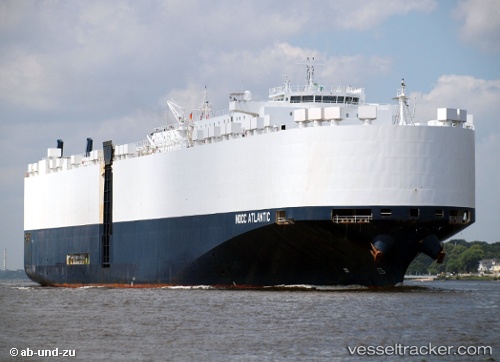
 Nocc Atlantic
Current Status
Where is the vessel?
Nocc Atlantic is currently in Open sea (no nearby ports in database), based on AIS data received less than 1h ago.
Latest AIS update:
Current position: 17.03475° S, 78.05368° E (Open sea (no nearby ports in database))
Average speed (last 7 days): Loading…
Average speed (last 30 days): Loading…
Vessel profile: Nocc Atlantic is a Vehicles Carrier with dimensions 200m x 32m.
This page combines live AIS, route history, probable destination signals, nearby traffic, and port activity for practical vessel monitoring.
The current position of vessel Nocc Atlantic is -17.03475 lat / 78.05368 lng. Updated: 2026-04-27 19:04:50 UTCNearest reference points:
- Open sea (no nearby ports in database)
- Open sea, approx. 532 nm off the nearest listed port
- Open sea, approx. 522 nm off the nearest listed port
Currently sailing under the flag of Norway ![]()
Nocc Atlantic built in 2009 year
Deadweight:
22500 tDetails:
Live Vessel Nocc Atlantic Analytics (details, animations, etc.)
Recent AIS points (UTC):
2026-04-27 16:18:58 UTC · -17.31667, 77.29833 · SOG 16 kn · COG -1°2026-04-27 16:21:56 UTC · -17.31167, 77.31333 · SOG 16 kn · COG -1°
2026-04-27 17:25:01 UTC · -17.20833, 77.59667 · SOG 16 kn · COG -1°
2026-04-27 19:04:50 UTC · -17.03475, 78.05368 · SOG 16.7 kn · COG 70°