 vesseltracker.com
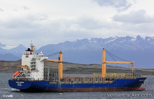
 Perito Moreno
Current Status
Where is the vessel?
Perito Moreno is currently in Near Kingston, based on AIS data received less than 1h ago.
Latest AIS update:
Current position: 17.83064° N, 76.74289° W (Near Kingston)
Average speed (last 7 days): Loading…
Average speed (last 30 days): Loading…
Vessel profile: Perito Moreno is a Container Ship with dimensions 175m x 27m.
This page combines live AIS, route history, probable destination signals, nearby traffic, and port activity for practical vessel monitoring.
The current position of vessel Perito Moreno is 17.83064 lat / -76.74289 lng. Updated: 2026-05-13 21:40:41 UTCNearest reference points:
- 16 nm SE of Ceiba Hueca
Currently sailing under the flag of Liberia ![]()
Perito Moreno built in 2009 year
Deadweight:
23294 tDetails:
Live Vessel Perito Moreno Analytics (details, animations, etc.)
Recent AIS points (UTC):
2026-05-13 17:59:51 UTC · 17.77627, -76.77570 · SOG 2.3 kn · COG 44°2026-05-13 19:46:00 UTC · 17.80923, -76.80223 · SOG 1.3 kn · COG 43°
2026-05-13 19:48:10 UTC · 17.80982, -76.80293 · SOG 1.9 kn · COG 41°
2026-05-13 21:40:41 UTC · 17.83064, -76.74289 · SOG 1 kn · COG 26°