 vesseltracker.com
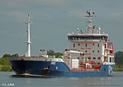
 Nike
Nike
Current Status
Where is the vessel?
Nike is currently in Near Nurme, based on AIS data received about 1h ago.
Latest AIS update:
Current position: 59.59307° N, 24.80042° E (Near Nurme)
Average speed (last 7 days): Loading…
Average speed (last 30 days): Loading…
Vessel profile: Nike is a Chemical Oil Products Tanker with dimensions 122m x 17m.
This page combines live AIS, route history, probable destination signals, nearby traffic, and port activity for practical vessel monitoring.
The current position of vessel Nike is 59.59307 lat / 24.80042 lng. Updated: 2026-05-15 19:30:43 UTCNearest reference points:
- Near Nurme
- Near Aegna
- Near Vanasadam
Currently sailing under the flag of Malta ![]()
Nike built in 2009 year
Deadweight:
7770 tDetails:
Live Vessel Nike Analytics (details, animations, etc.)
Recent AIS points (UTC):
2026-05-15 17:00:44 UTC · 59.59308, 24.80038 · SOG 0 kn · COG 131°2026-05-15 18:15:44 UTC · 59.59301, 24.80023 · SOG 0.1 kn · COG 122°
2026-05-15 19:18:45 UTC · 59.59294, 24.80016 · SOG 0 kn · COG 117°
2026-05-15 19:30:43 UTC · 59.59307, 24.80042 · SOG 0.1 kn · COG 121°