 STATIA CONDOR
Current Status
Where is the vessel?
STATIA CONDOR is currently in Near Oranjestad, based on AIS data received about 14h ago.
Latest AIS update:
Current position: 17.50524° N, 63.01141° W (Near Oranjestad)
Average speed (last 7 days): Loading…
Average speed (last 30 days): Loading…
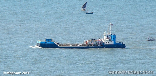
Vessel profile: STATIA CONDOR is a Tug with dimensions 31m x 11m.
This page combines live AIS, route history, probable destination signals, nearby traffic, and port activity for practical vessel monitoring.
The current position of vessel STATIA CONDOR is 17.50524 lat / -63.01141 lng. Updated: 2026-05-23 13:47:34 UTCNearest reference points:
- Near GUSTAVIA
- Near ST MAARTEN
- Near Saint John's
Currently sailing under the flag of Virgin Islands (U.K) ![]()
STATIA CONDOR built in 2009 year
Deadweight:
125 tDetails:
Live Vessel STATIA CONDOR Analytics (details, animations, etc.)
Recent AIS points (UTC):
2026-05-23 10:18:10 UTC · 17.50502, -63.01148 · SOG 1.7 kn · COG 135°2026-05-23 12:25:06 UTC · 17.50517, -63.01132 · SOG 0.5 kn · COG 60°
2026-05-23 13:40:36 UTC · 17.50512, -63.01137 · SOG 0.1 kn · COG 100°
2026-05-23 13:47:34 UTC · 17.50524, -63.01141 · SOG 0.6 kn · COG 92°